LARAPINTA TRAIL NORTHERN TERRITORY - SECTION HIGHLIGHTS
Larapinta Trail – Northern Territory

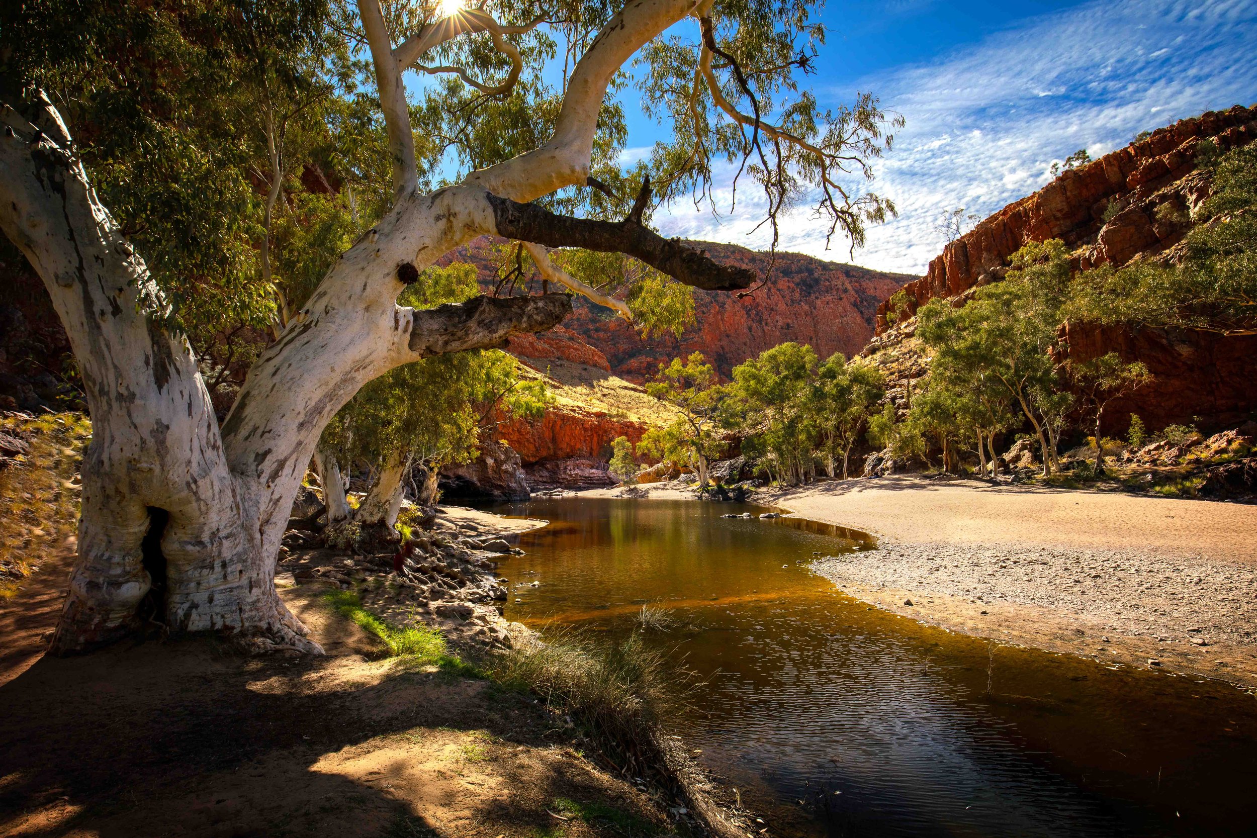
Simpsons Gap
Trail/Location
The Larapinta Trail is a 223km trek located in the West MacDonnell Ranges to the west of Alice Springs. It is broken up into twelve sections and is traditionally completed in an east to west direction.
Best Time to Walk
Winter is the ideal time, avoiding the extreme summer heat and flies. Late autumn and early spring are also okay, extending the walking season from late April to September.
The weather is extreme – During my hike (in June), Daytime maximums ranged from 12c to around 30c. Night-time temperatures ranged from below zero to 12c. Relentless sun. Chilly overcast days. Wind. Rain. It had everything - I was super-hot in relenting heat wishing for coolness. I was almost hypothermic in subzero cold wanting the sun. All within 15 days.
Hydration - The air is bone dry. When the temperature rises you really feel it. I was consuming up to six litres of water per day.

Sunset at Wallaby Gap
Trail and Terrain
Amazing scenery. Very unique. Varied – mountain tops, gorges, plains, plants, birds. It has it all.
Tough terrain – 80% of the trail is rock or sand. When it is dirt trail you are typically pushing through tall grass.

Swimming Hole at Hugh Gorge
Amenities and Facilities
Lovely campsites. A nice balance here. Clean and functional toilets (1 at each site). Raised platforms for preparing eating meals. Water tanks for water. Level campsites for camping. What more could you ask for!
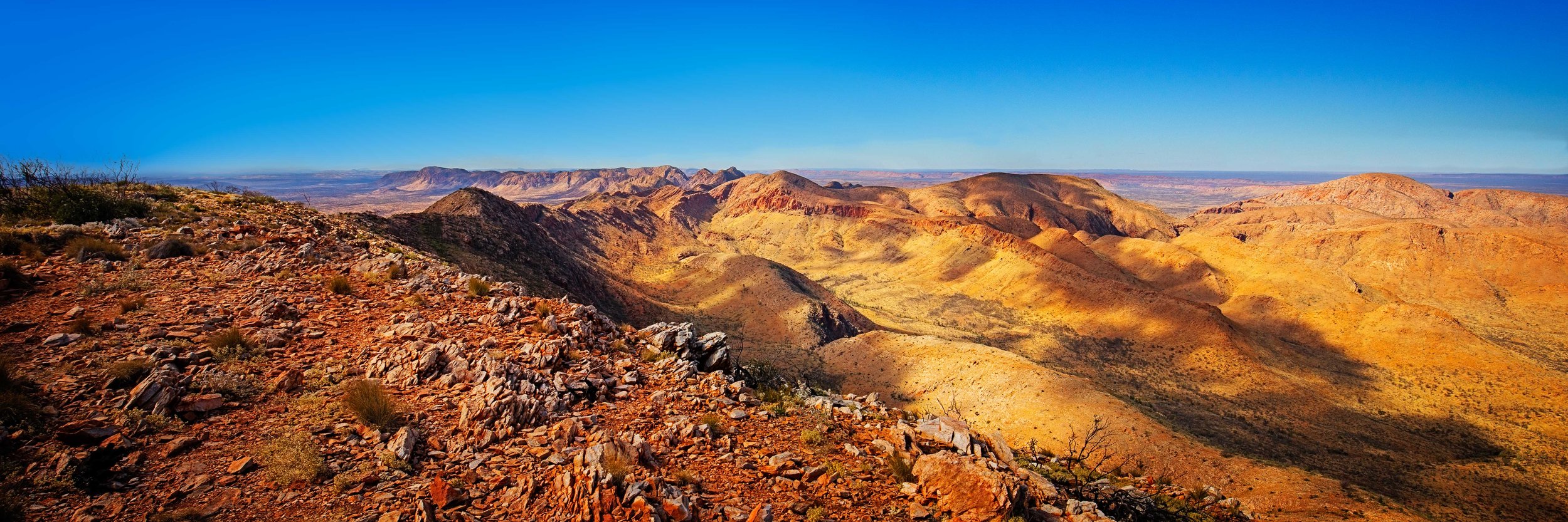
View looking East from Brinkley Bluff
Level of Difficulty
Tough walk – you are going up or down or pushing long distances across undulating terrain. A lot of trail is on rocky or sandy terrain. Having said this, it is not super intense. More about grinding out distance.
Would rate it a 7-8/10 for difficulty.
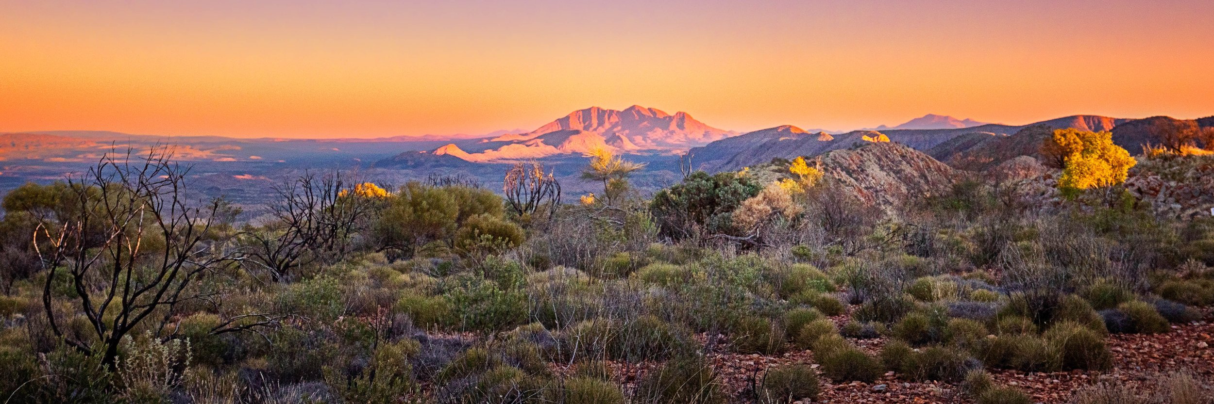
Sunrise over Mount Sonder
Hike Summary
Timing - I completed the hike in 15 days. This was about the right balance for me. Time to relax and take in the scenery but enough distance each day to sleep well at night. 3-4 tough days in the mix. I could have done it in 12 days but if I went back, I would add 1-2 days and spend some time pottering around the highlight areas.
Direction – Pros/Cons of doing either way. I think more special heading west. If you break up sections 1 and 2 a bit you can ease yourself into the walk and your body will thank you for it. Also gives you a day or two to really hydrate your body.
Safety - No wildlife issues to deal with (other than Trevor the dingo at Ellery Creek). Plenty of people on the trail. I had a Zoleo Satellite communicator for daily communication with the family so never really felt too far away from civilisation
Highlights – Sections 4 and 5 and last (western) part of Section 3
Lowlights – Climb to Mt Giles Lookout after lunch on a sunny afternoon with carried water. Overnight windstorm at Ormiston Gorge.
Conclusions
Magnificent scenery, vast open spaces and crisp clean air make this a truly unique experience.